The trip to Salem kicks off tomorrow, and so as a prelude to this trip, I thought it appropriate to introduce a mystery that has been disputed for hundreds of years in regards to the true location of Gallows Hill. To do this I follow the investigations and research conducted by Daniel V. Boudillion during the dates of 19 December 2006, 19 November 2006 4 October 2003, and 12 July 2003. His results yield some interesting clues and proposed location for the true site of Gallows Hill.
Introduction
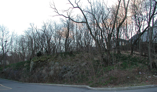
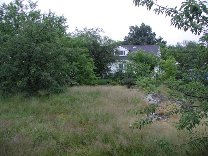
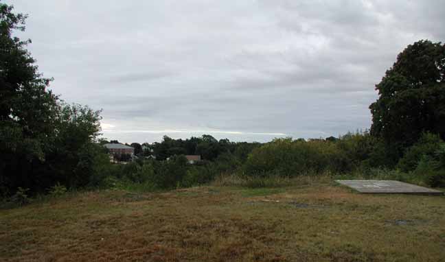 The "Official" Gallows Hill - Photo Credit: Daniel V. Boudillion
 The Salem witch trials occurred during the 1692 Salem Witch Hysteria which claimed the lives of 18 purported witches. These individuals would later be found not to be witches, but not before they were hung on a hill famously referred to as Gallows Hill, or as Daniel points out, Witch Hill or Witchcraft Hill. To this day the exact location of this hill is historically unknown, despite the town of Salem marking a location as Gallows Hill.
"For one thing, the hill was steep, and the thought of the accused being transported to the top in a cart, as it is known they were, seemed ludicrous upon having ascended the hill myself. Also, I had learned that Benjamin Nurse had rowed a boat from a creek near the Nurse Homestead, out into the North River, and then to the base of Gallows Hill to recover his mother’s body. It only took one look to see that there was no waterway contingent to the North River at the base of the hill I was standing on. There was no water at or even near the base of the hill The closest water was a canal over a quarter mile northeast. "
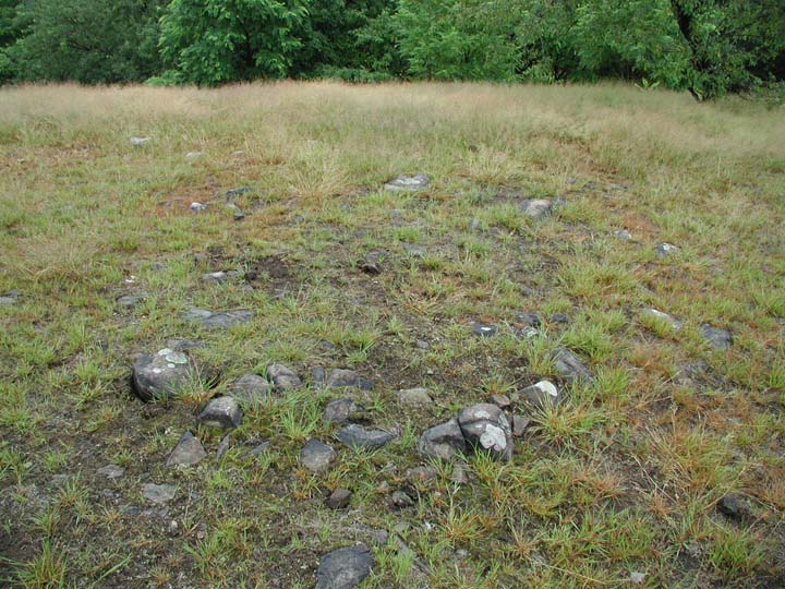
Trento's Gallows Hill
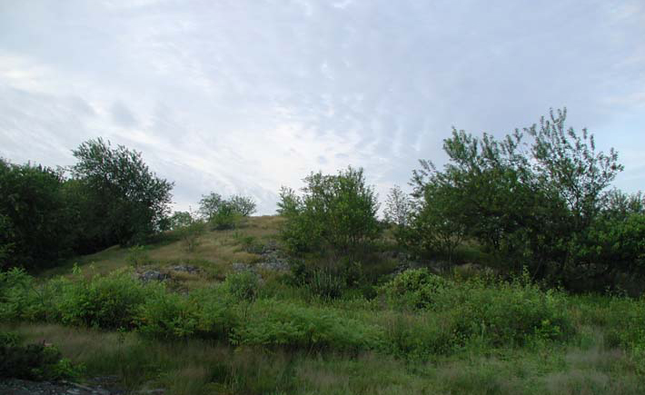 The site of Tento's Gallows Hill - Photo Credit: Daniel V. Boudillion
 In the book Field Guide to the Mysterious Places of Eastern North America by Salvatore Trento, Daniel finds that Salvatore also believed that the "official" Gallows Hill was a ruse and that the actual location remained unknown. Salvatore found a site that he believed was the actual location of Gallows Hill
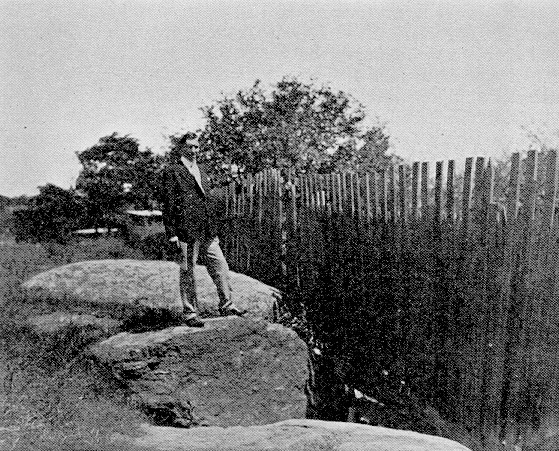
"So off I went in July of 2003 to locate this hill. I found it easily enough south of the playing fields in Gallows Hill Park, and about 200 yards Southwest of the water tank. It is a low grassy hill sloping down on its southern end. The north end was a knoll with a crevasse just over the side (history tells us the bodies were dumped in such places). The hill even had easy cart access up the south side from Colby Street, which looked liked it may have been a road back in the hanging times. "
The issue with this location though, as Daniel goes on to say, is that it is even further from any waterway than currently label location.
"So I went back to the books and refreshed my grasp of the known facts. Several things immediately invalidated the Trento site. First, he says the footing stones for the gallows are still visible. I have seen the stones he talks about, but the problem is that the accused were not hung on a gallows. Rather, they were hung from the branches of trees. Researchers have combed the meticulous records of the trial era, and not one mention was found of a gallows, and more tellingly, there is no record of the cost to purchase wood and construct such a gallows. "
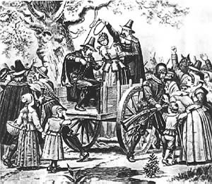 Correct depiction of the hangings | 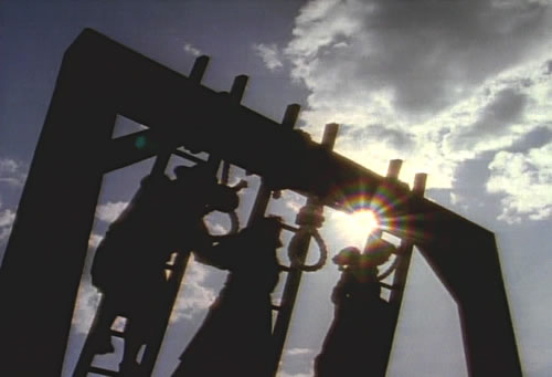 Incorrect depiction of the hangings |
The issue with the Trento location is that the appraoch that the carts that the witches were brought up in would have had to approach from the Colby Street area which is not what is historically recorded. It is recorded that the carts in fact passed over the Town Bridge which is by Daniel's estimation, the intersection of Boston Street and Bridge Street. This makes Trento's Gallows Hill highly unlikely as the true location.
Upham's Gallows Hill
 Upham's Gallows Hill
 Reverend Charles Upham had declared the current site of Gallows Hill in 1867, and since then it has been considered the only probable location of the hill. Daniel disputes this by quoting the Reverend himself who had no true evidence of the locations legitimacy.
"Historians and officials have followed his lead ever since, even though in Upham’s own words, 'There is no contemporaneous nor immediately subsequent record that the executions took place on the spot.'"
Interestingly, Daniel feels this location was accepted so readily because of the communities embarrassement of the events that transpired two hundred years earlier. Daniel goes on to say:
"By the time of Upham’s writing, the actual site, wherever it was, had dropped from public consciousness. The entire hanging episode was an acute embarrassment and shame to the community, and although the site was known to people, it was not publicly proclaimed or celebrated. Rather, the subject, and therefore the location, was avoided and a kind of collective amnesia occurred in regards to the location. People simply wanted to forget, and thus the location was 'forgotten' too. "
The Perley Hypothesis
Due to the mystery surrounding the location, many have taken a scientific stance on finding its location. One such individual mentioned by Daniel is Sidney Perley who researched Gallows Hill in 1921. Like others, Sidney didn't believe that Upham's Gallows Hill was the true location of the witches fate.
"Perley did discover a number of important clues. He was able to reconstruct the landscape and land ownership of Salem at the time of the hangings, making a number of maps. A final and composite map of Salem circa 1700 drawn from his work was assembled by William Freeman and published in 1933." | 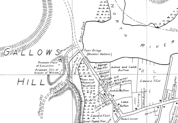 Freeman's 1933 map based on Perley of 1700 Salem showing actual Gallows Hill |
One of such clues discovered by Perley was from a letter written in 1791 by a Dr. Holyoke who described a man who had passed in Salem that was 100 years olds and thus was born in 1692, the time of the hangings. The man, by the name of Mr. Symonds, had told Dr. Holyoke that the nurse who helped birth him had frequently told him of her experience of seeing the victims of the hanging out of the window on Gallows Hill while tending to his mother. As Daniel describes:
 Pearly's map showing actual Gallows Hill and Symonds sightlines | "Perley was able to locate the house Symonds was born in and found that it was impossible to see the supposed hanging site on the southern end of the hill, let alone Gallows Hill. Ledge Hill completely blocks the view. However, a nearer lower hill that better fits the facts of the circumstance was well in view." |
The description of the location and the house found by Perley is very promising because of several facts known about the actual location.
"First, it is over the town line. Second, it is easily accessible by cart. Third, the hill was of sufficient height that Salem was observable from it, a noted fact. Forth, at the time, the North River extended in a large bay all the way to Town Bridge. The modern canal is simply all that is left of the bay after it was filled in. In 1692 the Town Bridge crossed a small arm of the North River bay called Bickford’s Pond. Bickford’s Pond abutted the small hill. This fits with the story that Benjamin Nurse was able to row his boat all the way to the base of the hill. Fifth, the small hill supported substantial trees, whereas Upham reports of the official Gallows Hill site that the "scattered patches of soil are too thin to tempt cultivation." Thus no trees, and recall that there is no evidence of an actual gallows erected - so how were they hung, then? Sixth, the hill may be plainly seen from John Symonds’s birthplace, exactly as his nurse said. "
John Adam's Account of Locust Trees
Locust trees were reported to have been planted in the area. This was confirmed b y President John Adam's in 1766 who had stated:
"Somebody within a few years has planted a number of locust trees over the graves, as a memorial." This minor detail proves to be a great clue to Perley as Daniels goes on to say: "Adams was incorrect about them being a memorial, however the clue of the locust trees led Perley to inquire of the owner of the small hill if locust trees had ever grown there. Indeed they had, although recently cut down. No locust trees or memory of locust trees were found on Upham’s choice of Gallows Hill." | 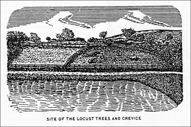 Perley's sketch of actual Gallows Hill |
Rowing from Rebecca Nurse's House
The Nurse family recounts that when Rebecca Nurse was hanged, her brother Benjamin rowed from their house up to Gallows Hill to retrieve her body.
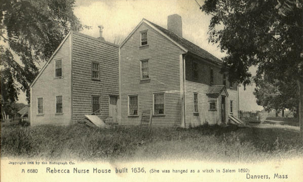 Rebecca Nurse's Home | 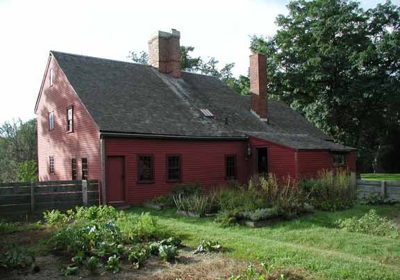 Rebecca Nurse's Home Today |
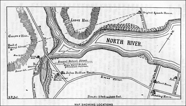
"The route Benjamin would have taken started from Crane Brook on their property, passing east under Hadlock’s Bridge, then further east under the Crane River Bridge on Ipswich Road, and out into the Crane River proper, a tidal bay. He would have continued rowing east to where the Crane River joined the Wooleston River, another tidal bay. He would have turned South into the North River near Skerry’s Point in Salem Town were they original lived before buying the farm in Salem Village. Down the North River, a tidal bay, he rowed, then under Town Bridge and into Bickford’s Pond. " | 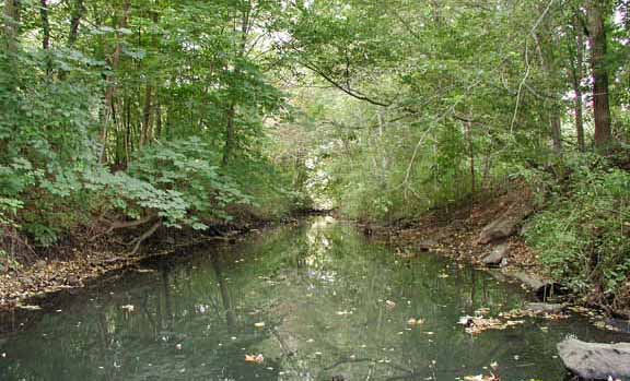 Crane Brook behind the Rebecca Nurse House |
 Nurse family Cemetery | "Proctor Street occupied the 20 foot wide flat between the pond and the hanging hill, which rose about 30 feet high. Rebecca’s body was dumped in a crevasse on the face of the hill. He would have retrieved her body from the crevasse and rowed back to the homestead where his older brother Samuel (who had adjoining property) and father Francis buried her in an unmarked grave. " |
Based on Perley's observations, research, and investigation, along with Daniel's own findings, it becomes obvious that the "official" Gallows Hill is not accurate at all and that the real Gallows Hill is yet to be discovered.
Daniel Visits the Perley Site
Upon looking over the details, and settling on the location outlined by Perley, Daniel took the opportunity to visit the site himself which he details in his account.
"On November 19, 2006, I visited the Perley site. It is located at the junction of Boston, Bridge, and Proctor Streets. This intersection was actually Town Bridge three hundred years ago. From here, turn onto Proctor Street. Today Proctor Street curves up behind the hill, but back in 1692 it curved in front of the hill. In any event, the hill is behind the Walgreens and the parking lot butts up against it. Proctor Street used to curve along it face between the hill and the pond. Walgreens is where the pond used to be. The Witch Hill GPS coordinates are: 42.5180N, -70.9100W." | 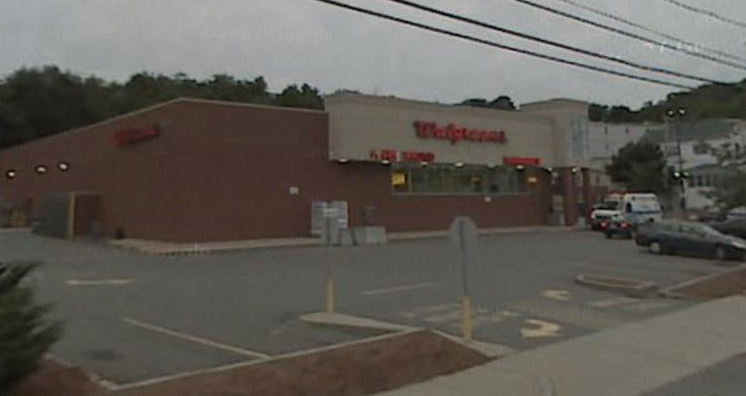 Walgreens at the Corner of Bridge & Proctor - Image provided by Google Earth |
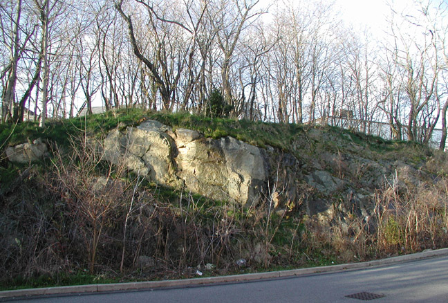
You will notice that the face of the hill behind Walgreens is steep and rocky. This is due to a since-removed railway that was put through along the base of the hill in the 1870’s.
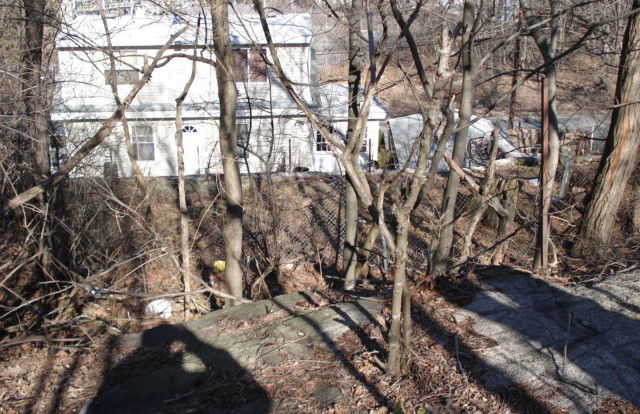
"The hangings took place on the flat of the hill directly behind and overlooking the parking lot near the hill’s northeast end. This area is now a small grove of young trees in a Proctor Street resident’s backyards."
Due to the construction of the railroad in the late 1800's, the hill was physically deformed which might have exacerbated its mystery location.
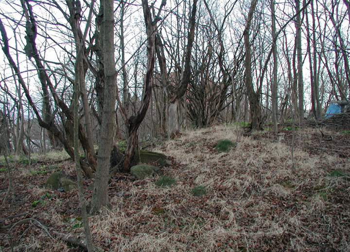
 The hangings were on the top of this knoll, in the center of the picture. | Here is the same location seen from the extreme far left of the above picture: 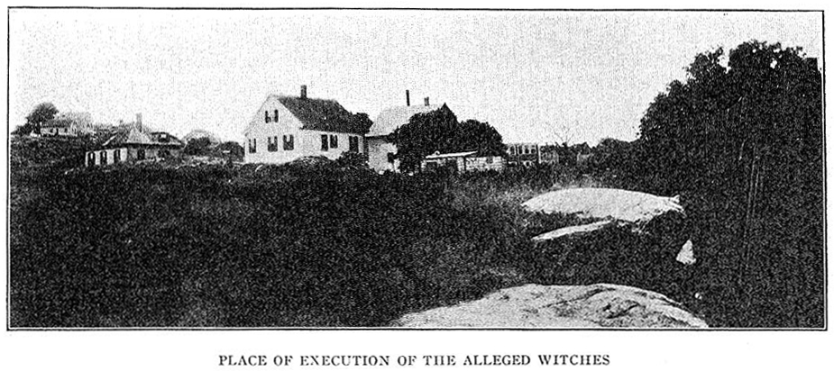 Actual Gallows Hill location from Perley's History of Salem Note the "official" Gallows Hill high above in the upper left side of picture (photo courtesy of Eric Lawison) |
"The crevasse is further down the length of the hill, near where Pope Street turns left past the Walgreen's parking lot. The actual location appears to be in someone’s side yard."
 | 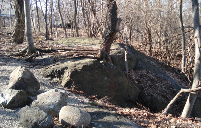 |
Crevasse in Perley's History of Salem (1924) and in 2009 by Eric Lewson
View From Where the Witches were Hung - Photograph courtesy of Eric Lewison
The hangings were here in this "witch's woods."
Based on personal research and compiled information from former researchers, Daniel concludes that this is the true Gallows Hill and location where the witches were hanged.
Tomorrows Trip
Hopefully this gives you a little chill knowing that to this day not all the mysteries surrounding Salem and the Witch Hysteria are know. I encourage everyone to keep an eye out tomorrow during the trip and if you get the opportunity, try to get a look at the Perley site and make your own judgements!
Have a great trip!
Have a great trip!
Jason Bristol
Webmaster
Webmaster

 RSS Feed